
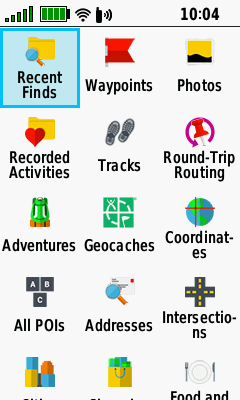
- The GPSMAP 66 features advanced waypoint management capabilities.
- The GPSMAP 66 can index as many as 10,000 waypoints.
- Waypoints created on the device are saved as GPX files in the [GPSr]\Garmin\GPX directory.
- Waypoints can be manually loaded to both the [GPSr]\Garmin\GPX and [microSD]\Garmin\GPX directories.
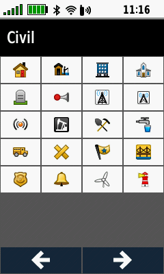
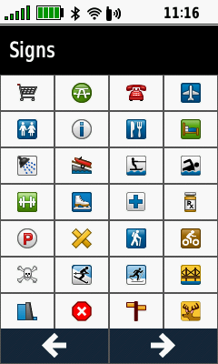
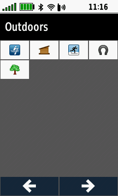
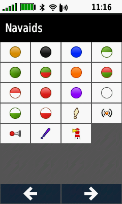
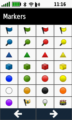
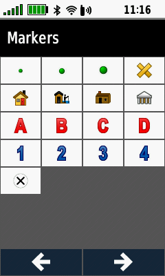
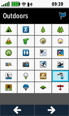
Waypoint Symbols
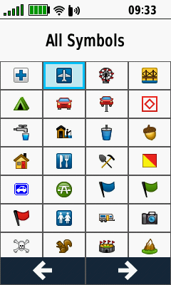
- Press (+) / (�) to scroll all available waypoint symbol pages, sorted by category.
- Some symbols may appear in multiple waypoint symbol categories.
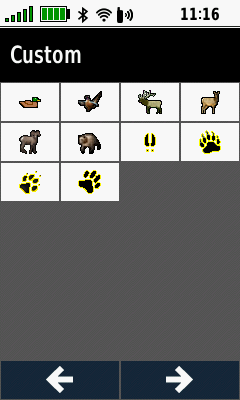
- Learn how to create your own custom waypoint symbols.
- GPSMAP 66 default waypoint symbols by category (updated with firmware version 3.10):
 |
|
 |
|
|---|---|---|---|
 |
 |
 |
|
 |
 |
 |
|
 |
 |
 |
Waypoint List
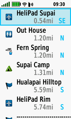
Select Waypoint
 |
 |
 |
 |
|---|---|---|---|
| Open Waypoint Manager |
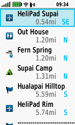
Waypoint Manager lists waypoints by proximity |
Select desired waypoint | Press (Menu) for Search Options |
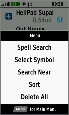
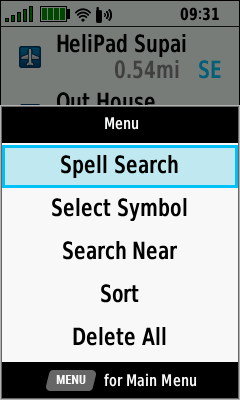
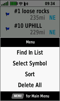
Spell Search
 |
 |
 |
 |
|---|---|---|---|
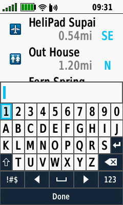
| Press (Menu) and Select [Spell Search] |
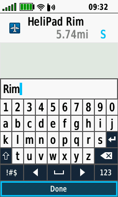
Enter desired search term |
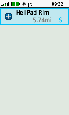
Select [Done] | Waypoints with search term listed by proximity |
Select Symbol
 |
 |
 |
 |
|---|---|---|---|
| Press (Menu) and Select [Select Symbol] |
Choose desired symbol | Press (Enter) | Waypoints with selected symbol listed by proximity |
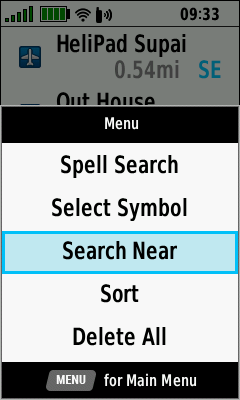
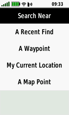
Search Near
 |
 |
||||
|---|---|---|---|---|---|
| Press (Menu) and Select [Search Near] |
Choose desired search near option |
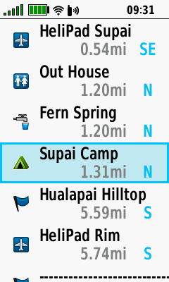
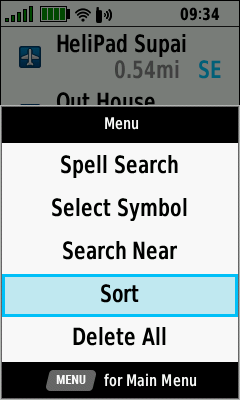
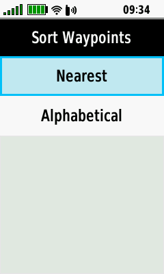
Sort
 |
 |
 |
 |
|---|---|---|---|
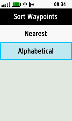
| Press (Menu) and Select [Sort] |
Select [Nearest] | Waypoints listed by proximity |
[Sort > Nearest] option menu |
 |
 |
 |
|
| Select [Alphabetical] | Waypoints listed alphabetically |
[Sort > Alphabetical] option menu |
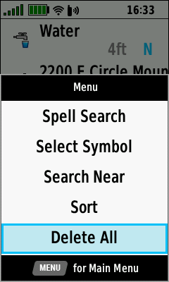
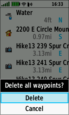
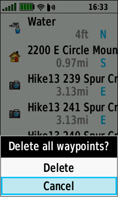
Delete All
 |
 |
 |
|---|---|---|
| Press (Menu) and Select [Delete All] |
Select
[Delete] to Delete All Waypoints |
Select [Cancel] to Abort |
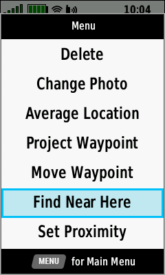
Waypoint Menu
Edit Symbol
- Not all Garmin GPSr share identical waypoint symbol sets. This can result in some waypoints being displayed with a different symbol on other devices.
- Tip: The 'Blue Flag' and/or 'Blue Pin' waypoint symbols may not appear on the map screen on some devices when applied to routes or courses.
 |
 |
 |
|
|---|---|---|---|
| Select [Symbol] Press (Enter) |
Select desired waypoint symbol |
Waypoint symbol is updated |
Edit Name
 |
 |
 |
|
|---|---|---|---|
| Select [Name] Press (Enter) |
Enter
waypoint name Select [Done] and Press (Enter) |
Waypoint name is updated |
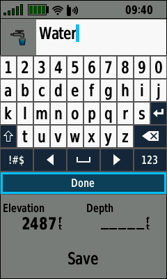
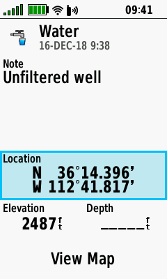
Edit Note
 |
 |
 |
|
|---|---|---|---|
| Select [Note] Press (Enter) |
Enter
waypoint note Select [Done] and Press (Enter) |
Waypoint note is updated |
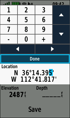
Edit Location
 |
 |
 |
|
|---|---|---|---|
| Select [Location] Press (Enter) |
Edit coordinates Select [Done] and Press (Enter) |
Waypoint location updated |
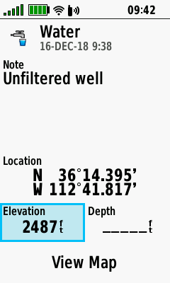
Edit Elevation
 |
 |
 |
|
|---|---|---|---|
| Select [Elevation] Press (Enter) |
Enter
elevation value Select [Done] and Press (Enter) |
Waypoint elevation is updated |
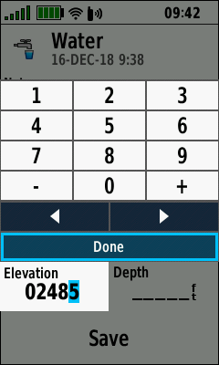
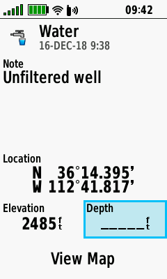
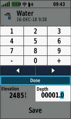
Edit Depth
 |
 |
 |
|
|---|---|---|---|
| Select [Depth] Press (Enter) |
Enter
depth value Select [Done] and Press (Enter) |
Waypoint depth is updated |
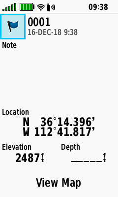
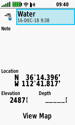
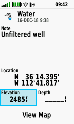
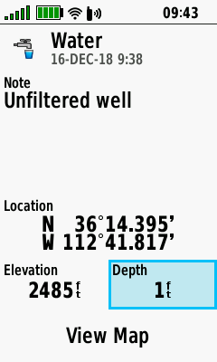
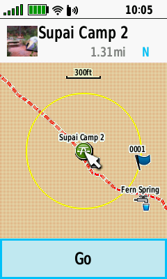
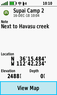
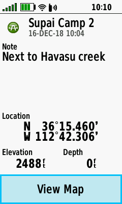
View Map
 |
 |
 |
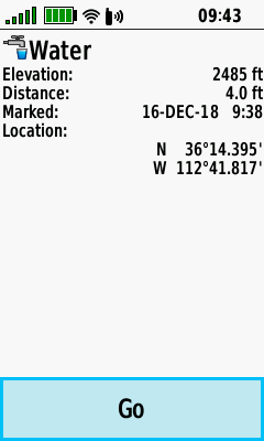 |
|---|---|---|---|
| Select [View Map] Press (Enter) |
Waypoint displayed on Map page |
Press (Menu) and Select [Review Point] |
Waypoint details are displayed |
Option Menu
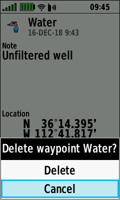
Delete Waypoint
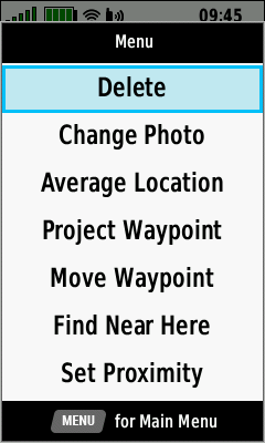 |
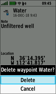 |
 |
|
|---|---|---|---|
| Press (Menu) and Select [Delete] |
Select [Delete] to proceed | Select [Cancel] to abort |
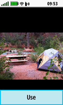
Change Photo
 |
 |
 |
 |
|---|---|---|---|
| Press (Menu) and Select [Change Photo] |
Select desired photo and Press (Enter) |
Select [Use] and Press (Enter) |
Waypoint displayed using selected photo |
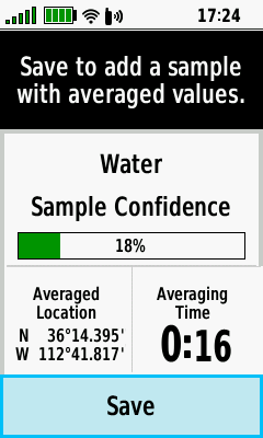
Average Location
 |
 |
 |
 |
|---|---|---|---|
| Press (Menu) and Select [Average Location] |
Select [Start] and Press (Enter) to begin |
Select [Yes] and Press (Enter) to proceed |
Confidence level will fluctuate during sampling process |
 |
 |
||
| Select [Save] and Press (Enter) when confidence level value is acceptable |
Waypoint coordinates and sample count are updated Select [Done] and Press (Enter) to complete |
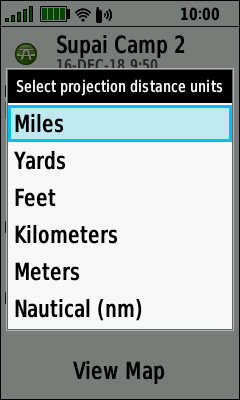
Project Waypoint
 |
 |
 |
 |
|---|---|---|---|
| Press (Menu) and Select [Project Waypoint] |
Enter desired bearing Select [Done] and Press (Enter) |
Select desired distance units |
Enter desired distance Select [Done] and Press (Enter) |
 |
 |
 |
 |
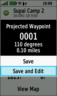
| Select [Save] to return to waypoint list |
Select [Save and Edit] to view projected waypoint |
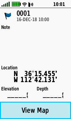
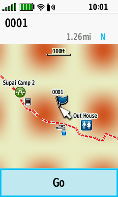
Projected waypoint details Select [View Map] and Press (Enter) |
Projected waypoint map Select [Go] and Press (Enter) to begin navigation |
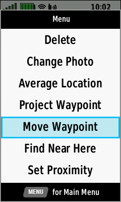
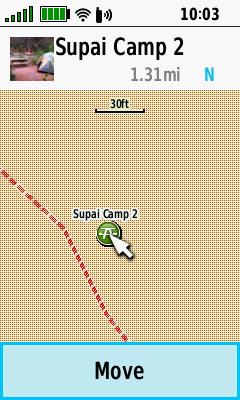
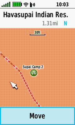
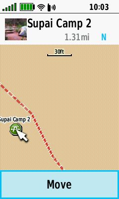
Move Waypoint
 |
 |
 |
 |
|---|---|---|---|
| Press (Menu) and Select [Move Waypoint] |
Select [Move] and Press (Enter) |
Use D-PAD to move pointer to new location |
Press (Enter) to relocate waypoint |
Find Near Here
 |
 |
 |
 |
|---|---|---|---|
| Press (Menu) and Select [Find Near Here] |
Select from available waypoint's and POI's | ||
Set Proximity
 |
 |
 |
 |
|---|---|---|---|
| Press (Menu) and Select [Set Proximity] |
Enter desired radius Select [Done] and Press (Enter) |
Select [View Map] and Press (Enter) |
Proximity ring displayed around waypoint |
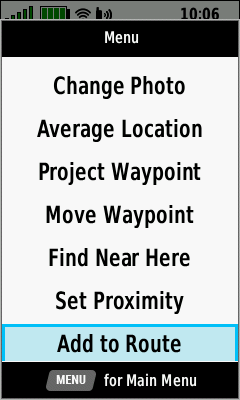
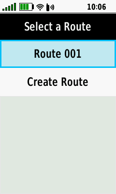
Add to Route
 |
 |
 |
|
|---|---|---|---|
| Press (Menu) and Select [Add to Route] |
Select desired route, or create a new route |
Waypoint successfully added to selected route |
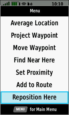
Reposition Here
 |
 |
 |
|
|---|---|---|---|
| Press (Menu) and Select [Reposition Here] |
Original waypoint location | Updated waypoint location (current GPSr position) |